Planning for Places, Not Uses
By Brooke Murphy
Land use rules decide more about daily life than most people realize. They decide what kinds of homes are legal to build, and so who can afford to live in a community. They decide where homes and businesses go, and so how far people drive to buy groceries, see a doctor, or pick up their kids.
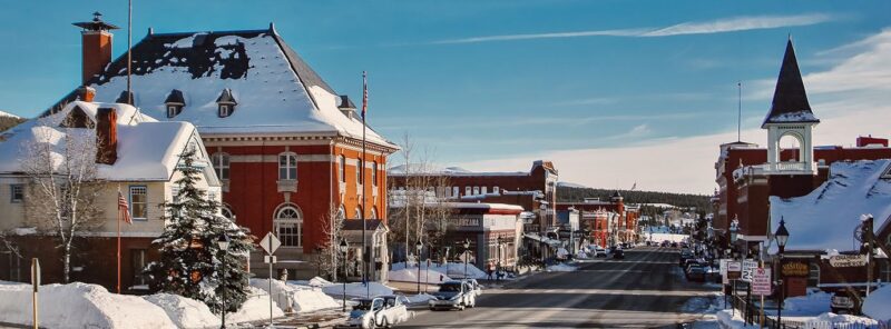
A rural community at a crossroads
In 2024, Lake County and the City of Leadville were fielding more development interest than they had in years. Staff and elected officials were struggling to find a shared, consistent way to decide which proposals to say yes or no to, and didn’t have a clear picture of what residents wanted the community to become.
“We were at a crossroads,” said Anne Schneider, Director of Community Planning & Development for Lake County. “We were getting a huge increase in development interest, and a lot of needs had basically been kicked down the road. I really felt we needed a way to set our north.”
Setting that north meant solving a traditional land use problem. The technical work, like mapping hazards and calculating how much growth water and sewer systems can carry, usually happens apart from the community. Residents are asked what they want, often without the information they would need to weigh it. We set out to build a framework that would put both in the same room.
 Why sorting land by use falls short
For a century, the default in American planning has been to sort land by use: homes in one zone, shops in another, industry in a third. That approach helped produce places where every errand takes a car, downtowns empty when the shops close, and neighbors rarely run into each other. Planners have spent years reforming these codes, loosening rules that block good projects while making sure what gets built still adds to the place.
Place types are one tool for that work. A place type describes the kind of place an area should become: how it looks, what it’s for, and how people move through it. That reaches past zoning to the street design, trail and transit connections, and building form that shape how a place works and feels.
The instinct is to start from a proven model. Most place type frameworks were built around urban patterns. Blueprint Denver, for example, layers neighborhood contexts like “urban center” and “suburban” with place types like centers and corridors, and assumes streets, water, and sewer reach nearly everywhere.
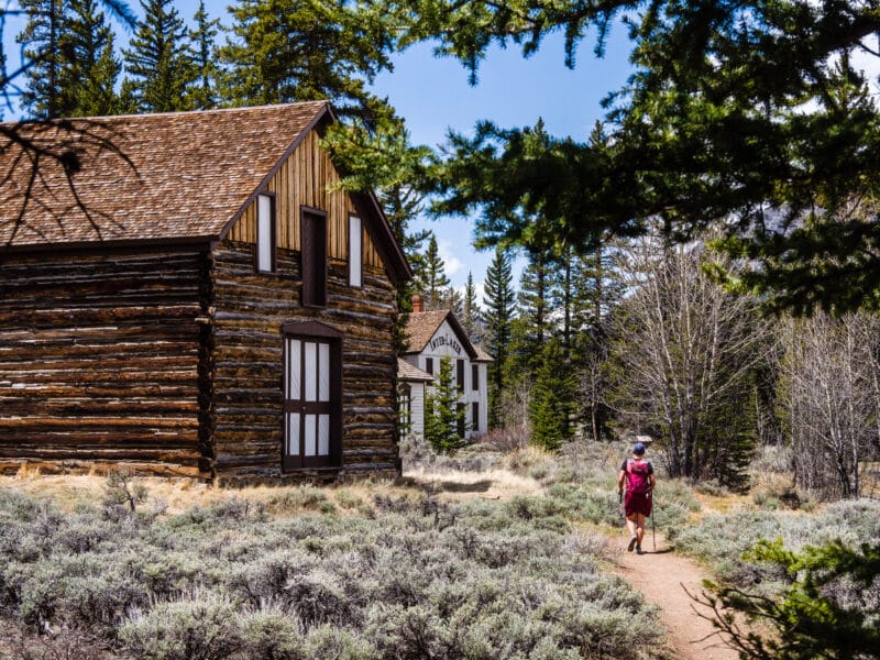
Lake County has a historic city in the north and a historic village in the south, unincorporated land around both, mining and industrial areas, and large areas of sensitive land. Water and sewer reach few places. A template built for an urban area would have described places and street types that don’t quite exist here, so we needed to build one that fits this community’s context, needs, and goals.
Two layers, one built on the other
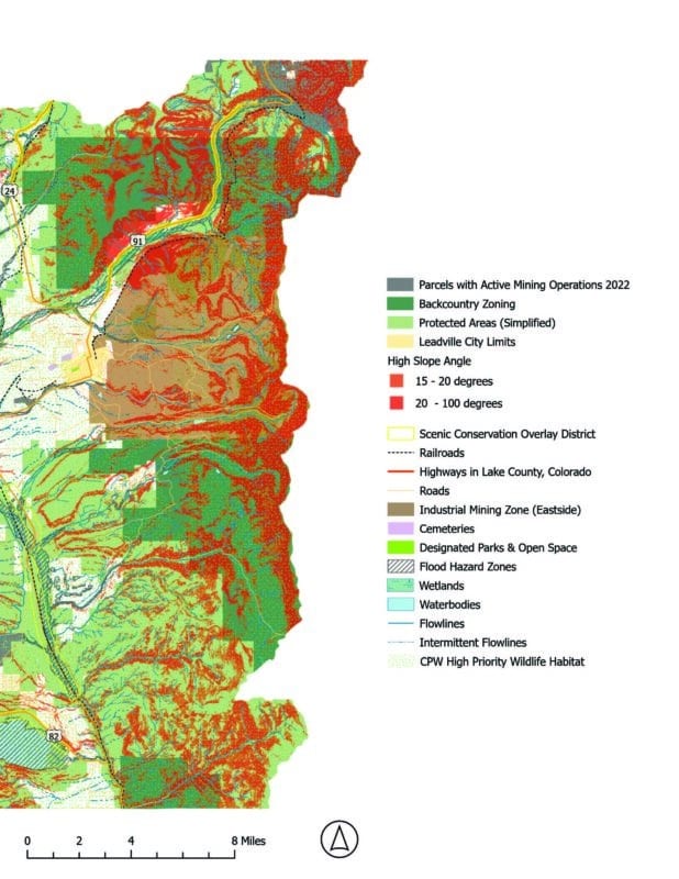
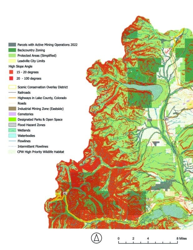
Development contexts set out where and how much growth makes sense over the next ten years. We used GIS data to identify where little or no development should happen, including hazard areas, conservation land, sensitive ecosystems, and industrial and mining areas. Then we layered in transit, infrastructure, and water and sewer service areas.
Place types sit on that foundation. Instead of asking what use belongs on each lot, we asked community members what kinds of places they wanted, and built the place types from their language and lived experience.
Each place type holds four kinds of information: how the place looks and feels; what it’s for; how people get there and move through it; and how different uses relate to each other. The last one is where place types go furthest past zoning. A code can say a shop is allowed next to a house. A place type can say the shop should fit comfortably there, small enough that the block still feels residential.
Putting maps in the hands of community members
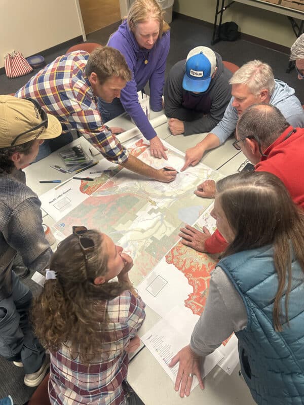
In community workshops, we rolled out the maps and walked through the technical information together. Then we uncapped the markers and handed them to residents. People worked through what the hazard areas, service lines, and capacity limits meant for where homes and businesses should and shouldn’t go.
Working this way gave community members both agency and information to weigh trade offs and make choices about what their community becomes, in terms they recognize. Future place types then map their decisions and desired outcomes on the ground for both Leadville and Lake County.
What it looks like in practice
Two place types from the plan illustrate how we adapted place types to suit mountain town contexts.
In Leadville, the Working Neighborhood Corridor place type describes an evolving neighborhood hub, where small businesses, services, and housing come together on the old main street. Corner lots and historic commercial buildings anchor them, and shops on the ground floor with apartments above are encouraged. Buildings top out at three stories, and the block should still feel residential..
Just outside city boundaries on county land, the Mixed Use Neighborhood (Infill) place type covers established and future neighborhoods near Leadville. Where water and sewer are available, a range of housing is welcome, from duplexes and cottage courts to small apartment buildings, including workforce and affordable housing. Where land is still undeveloped, new neighborhoods should have connected streets, trail access, and a mix of housing from the start.
This second place type is where a borrowed framework would have fallen short. Its guidance turns on whether water and sewer reach the land, which ties it directly to the development contexts beneath it. It also asks county neighborhoods to connect to city streets, schools, parks, and services, so two governments plan as one community.
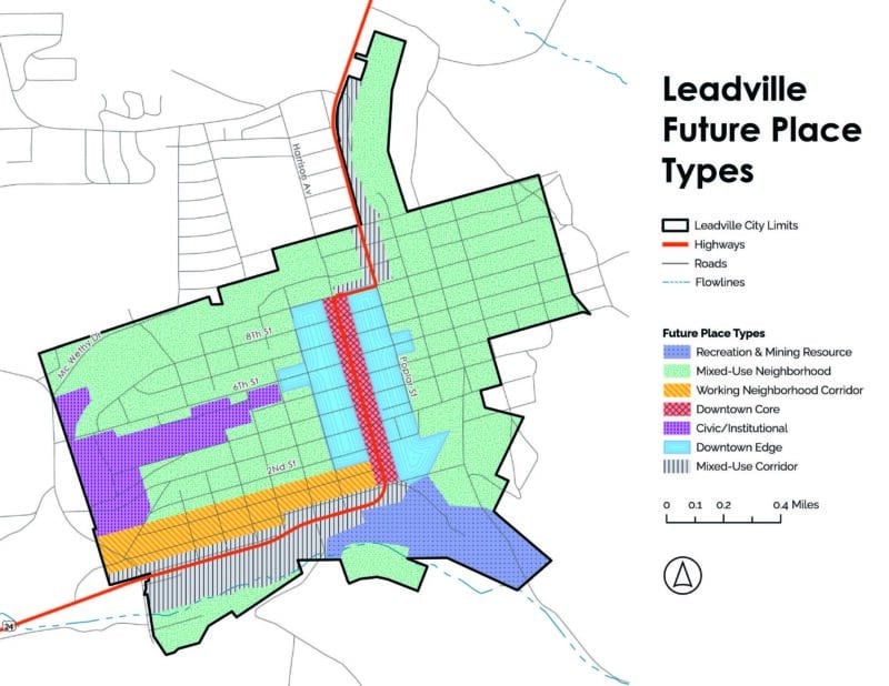
What place types do, and what they don’t
Place types and zoning do different jobs. Zoning regulates a specific lot, such as setbacks, height, density, lot coverage, and allowed uses. Place types describe what an area should become over time, and a single place type may be carried out through several zoning districts.
The Future Place Types maps don’t change what anyone can build tomorrow. Their value is a shared reference point. Staff, elected officials, builders, and residents can look at the same proposal and ask the same question: does this fit the place the community said it wants? Some zoning will need to change to support the place types set out by the plan, and that work comes next.
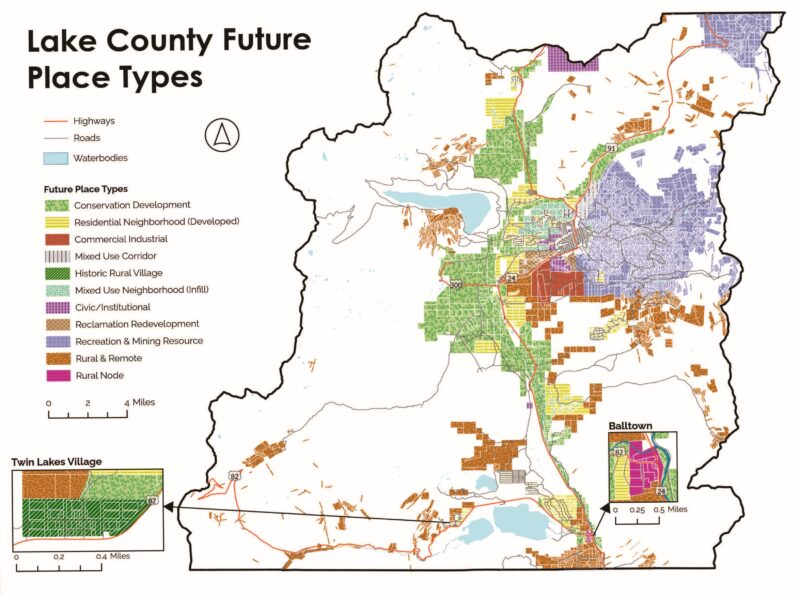
What we learned
The biggest lesson from this work was how to bring the technical work and the community into the same room. Development contexts put the technical limits on a map residents could read. Place types gave them language to decide what should happen within those limits: where different kinds of development belong, and how those places should look and work.
The City and County are expected to adopt the plan this December. Its real test will come as new proposals arrive. It was designed to hold up under that pressure, because the people who shaped it worked through the tradeoffs themselves.